Last Updated on September 14, 2023
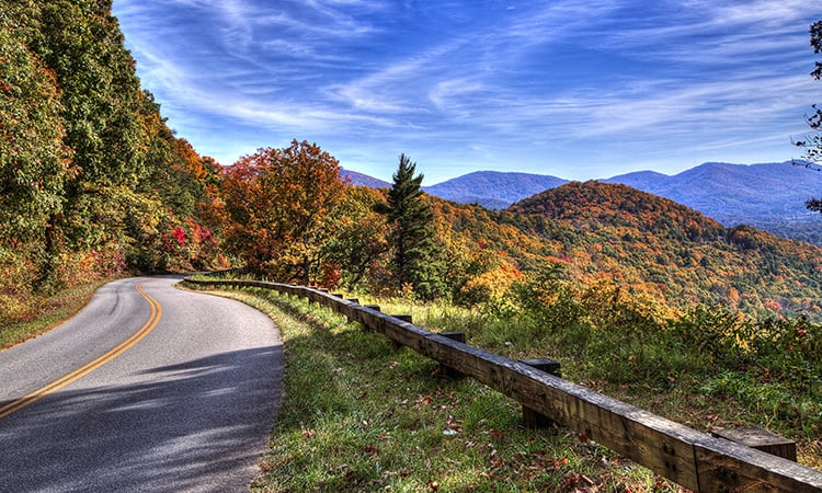
The Blue Ridge Parkway unravels gracefully across the landscape, at times suspended from high cliffs and etched into rocky crags, then deftly shifting gears to skim over hayfields and past log cabins bound by split-rail fences. It moves people from place to place and also binds the region together.
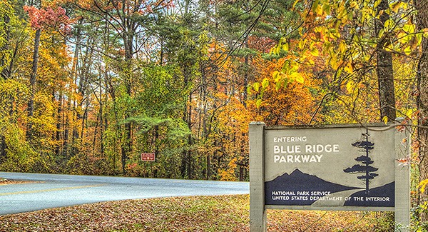
Anyone who has driven through the Southern Appalachians in North Carolina and Virginia has likely encountered the Blue Ridge Parkway—or a positive effect of its presence. Today, we’re sharing an overview of the road known as “America’s favorite drive”. Here is a complete beginner’s guide to the Blue Ridge Parkway.
Skip ahead! Or continue reading for:
- The Blue Ridge Parkway at a glance
- History of the Blue Ridge Parkway
- Geography & design of the Blue Ridge Parkway
- Blue Ridge Parkway climate & wildlife
- Blue Ridge Parkway recreation & things to do
- BRP seasonal access & safety
The Blue Ridge Parkway at a glance
Length: 469 miles (755 km)
Elevation: 649–6,047 feet
Parkway hours: 24 hours a day, weather permitting
Dates constructed: 1935–1987
Purpose: Recreational motor road connecting Shenandoah and Great Smoky Mountains National Parks.
Fast facts:
- Known as “America’s favorite drive”
- Traverses 29 counties in Virginia and North Carolina
- 26 tunnels along the route (1 in Virginia, 25 in North Carolina)
- Holds the title of the longest linear parkway in America
- #1 most visited unit of the US National Park system for 70 of the past 74 years
- Generates $2 billion in revenue each year
History of the Blue Ridge Parkway
The Blue Ridge Parkway is a unique unit of the National Park Service, a scenic roadway through the rural mountains of Western North Carolina and Virginia. It was conceived as part of President Franklin D. Roosevelt’s New Deal programs to put Americans back to work during the Great Depression.
The task facing early Parkway designers was enormous, with little more than vague parameters of where to build the route. Blazing a scenic road through high and rugged mountain passes in the 1930s was an engineering and artistic feat. It also pushed the boundaries of competing American ideals.
The country was in the midst of a burgeoning national park movement, and many in the general public had already accepted a popular concept of preserving America’s grand landscapes. Meanwhile, a love affair with the automobile had likewise gripped the country. These two notions gave rise to the Parkway concept. Yet merging the two was not easy.
Stanley Abbott was just 26 years old when he was hired as chief landscape architect for the Blue Ridge Parkway project. Abbott possessed both the skill and instinct to capture the Appalachian countryside and its sweeping mountain vistas from behind the windshield of an automobile.
Abbott plugged away dutifully from 1935–1944 until he was called into service for World War II. By then, only two-thirds of the road had been completed. Construction resumed immediately after the war and continued in sections until 1967. The final missing link of seven miles around Grandfather Mountain was completed in 1987.
Geography & design of the Blue Ridge Parkway
4 Sections of the Blue Ridge Parkway
The Blue Ridge Parkway begins near Waynesboro, Virginia at the southern terminus of Skyline Drive, the scenic route that takes sightseers through Shenandoah National Park. It runs 469 miles due southwest into the Shining Rock Wilderness near Brevard before taking a turn to the northwest. The Parkway terminates at Newfound Gap Road in Cherokee, NC.
The Blue Ridge Parkway is divided into four geographical sections:
Ridge
Running from Afton, Virginia south past Roanoke, this first section encompasses miles 0–105.9. Most of this section runs through the George Washington and Jefferson National Forests, offering views of beautiful rolling pastures with both historical agricultural sites and those still in operation. One point of interest is the Peaks of Otter Lodge, located at milepost 86.
Plateau
From mileposts 106–216, you’re in the plateau region of Virginia, which runs all the way to the state line. This area is characterized by historic sites, varied landscapes, working farms, and traditional Blue Ridge music. There are many museums and attractions through this area, including Rocky Knob, a popular hiking and recreational area at milepost 169.0.
Highlands
Characterized by the high peaks through which it runs, the Highlands region of the BRP takes sight seekers from the NC state line (milepost 217) all the way to Crabtree Falls (milepost 339), the highest vertical-drop cascading waterfall east of the Mississippi. Along the way, you’ll drive through Boone, a popular skiing area, and nearby Blowing Rock, a scenic attraction overlooking the Johns River Gorge. Grandfather Mountain, Linville Caverns, and Linville Falls are also located along this section of the Parkway. And Little Switzerland, the “beauty spot” of the Blue Ridge, is located at milepost 334.
Pisgah
The tail end of the Parkway, known as the Pisgah Region (mileposts 340–469), offers a bevy of North Carolina attractions. The highest peak east of the Rockies, Mount Mitchell, is located just off milepost 355.4. The headquarters of the Parkway is located in Asheville, a city known for its world-class arts and dining. The Biltmore Estate, North Carolina Arboretum, and Cradle of Forestry (in neighboring Transylvania County) each played important roles in the history of conservation in America. The highest point on the Parkway (6,053 feet; 1,845 m) is located in Haywood County at milepost 431. Lastly, the Parkway terminates just outside the town of Cherokee, home of the Eastern Band of Cherokee Indians.
The math behind the Parkway’s design
The Parkway’s design is often compared to art, but Abbott and his colleagues applied a mathematical formula to achieve the serpentine line. Abbott was a master of the spiral curve, a highly engineered and deftly calculated arc that eases cars gently into a curve and exits them smoothly. The Parkway owes its sweeping nature to the equation, which avoids the unpleasant centripetal force of standard curves. Along with reverse curves and a carefully calculated gentle grade, the Parkway creates a rhythmic experience, as if swaying back and forth through the mountains.
Blue Ridge Parkway climate & wildlife
Much of the diversity along the Parkway comes from the area it spans, as well as the wide range of elevation it covers (649–6,047 feet). Elevation can drastically affect local weather, causing temperature variations of 10–20 degrees Fahrenheit from the communities in the foothills surrounding the Parkway to the crest of the mountains. In addition, clear skies in local communities do not guarantee equally pleasant weather at higher elevations. Be aware of changing weather conditions, including fog and poor visibility. Dress appropriately in layers for high elevations, even in summer.
Sections along the Blue Ridge Parkway, especially along the North Carolina legs, are among the most biodiverse areas in the world. Along the Parkway live about 100 varieties of trees, 1,600 plant species, 70 mammals, and 159 species of birds. In fact, the Parkway provides critical habitat for more than 50 threatened and endangered plant species. All plants are protected from poaching and illegal harvesting.
Among the most common animals spotted from the Parkway are white tailed deer, wild turkey, and—if you’re lucky—a black bear. Beavers are also making a comeback in the region. Owing to the high elevations, colorful wildflowers can be seen throughout spring, summer, and fall.
To protect the plants and wildlife you encounter, remember these guidelines:
- Keep your distance.
- Do not feed wild animals. Be sure to clean up after yourself, as well; do not leave any food behind.
- Stay on the trail to avoid trampling delicate plants and prevent erosion.
- Fishing is permitted in Parkway waters with a valid state fishing license from either Virginia or North Carolina.
Blue Ridge Parkway recreation & things to do
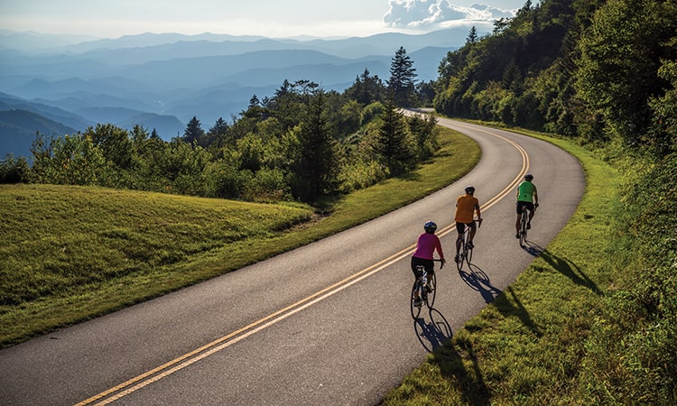
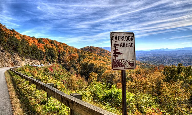
The Blue Ridge Parkway is first and foremost a scenic roadway. Locals and visitors navigate the road’s gentle curves and inclines via their cars, motorcycles, and road bikes throughout the year. With 200 scenic stops and overlooks along the route, there are ample opportunities for enjoying the many beautiful vistas of the Blue Ridge Mountains.
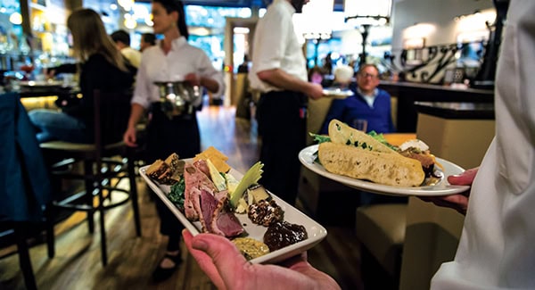
Visitors who do stop along the BRP find many reasons for doing so. The Parkway runs through many towns and villages, offering dining, entertainment, and lodging. Museums, attractions, and historical sites abound. There are 47 Natural Heritage Areas within the boundaries of the park. And the Parkway takes you up close and personal to many of the natural wonders of the mountains.
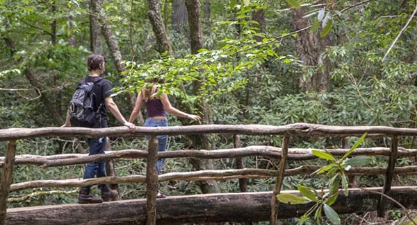
Hikers, mountain bikers, rock climbers, fishermen, and other outdoor enthusiasts find some of the best mountain trails and waterways in the world along the Blue Ridge Parkway. The French Broad River, one of the oldest rivers in the world, can be found running through the Pisgah Region. Mount Mitchell State Park, surrounding the highest peak in the Eastern U.S., features hiking trails, picnic areas, and an observation tower. The Parkway also hosts eight official campsites along its route.
From tall peaks to stocked rivers, waterfall hikes to equestrian trails—the mountains are your playground, and the Parkway is your access point.
BRP seasonal access & safety
The Blue Ridge Parkway is open 24 hours a day, weather permitting.
Along its route, the BRP crosses streams, railway ravines, six viaducts, and 168 bridges. During the winter months (November–April), many of these bridges are forced to close due to inclement weather, making portions of the Parkway inaccessible. In addition, sections of the road may also be closed during road maintenance projects. Check the National Park Service’s road closure map to verify that the Parkway is open before traveling.
Visitor centers and other facilities along the Parkway have hours and seasons that vary. Most picnic areas, campgrounds, and visitor centers are closed from the beginning of November until early May.
For more information, visit blueridgeparkway.org.